Hi all,
Quick update on Laura, which is now a hurricane.

Image: www.weathernerds.org
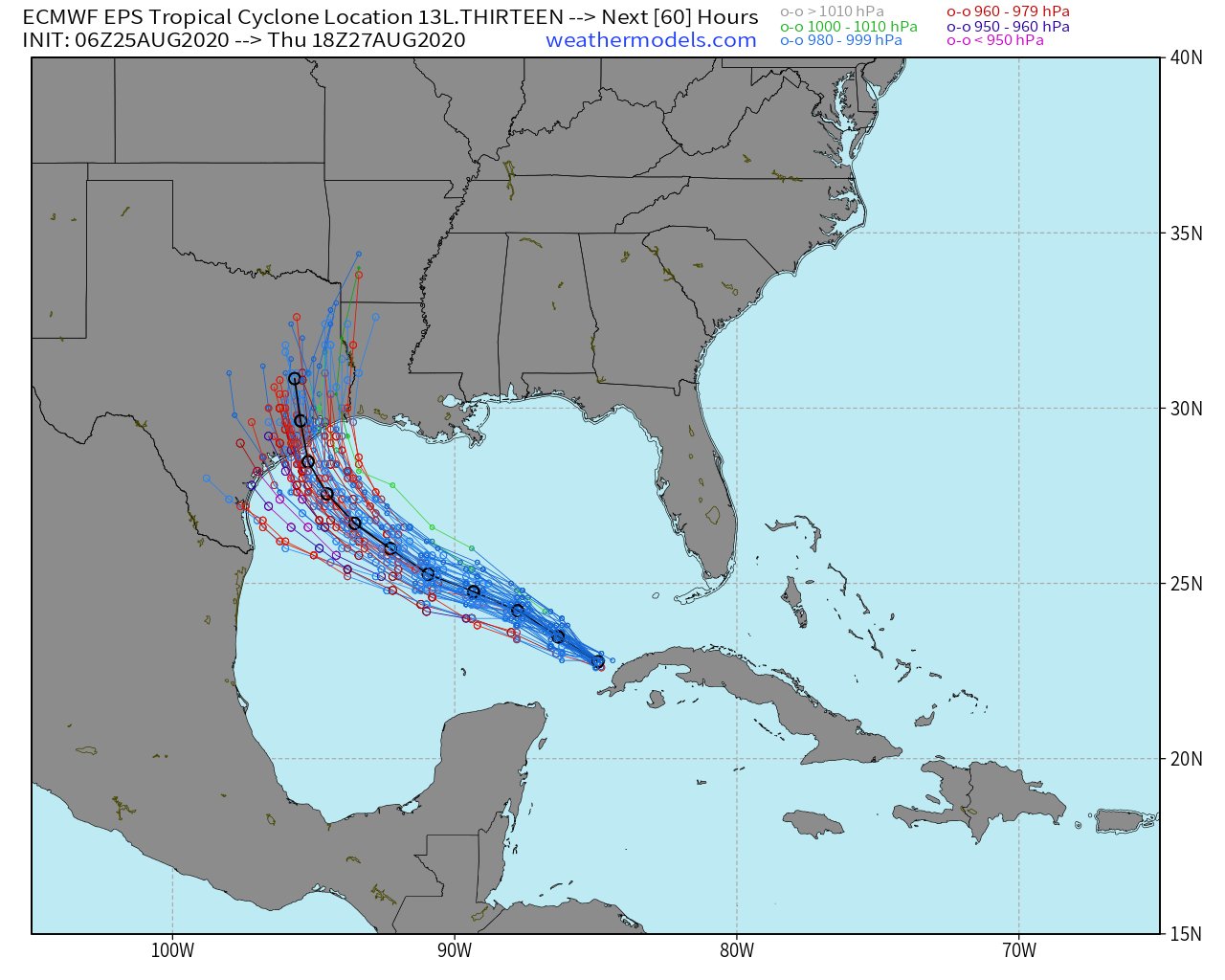
Laura is predicted to be a major hurricane (Category 3 or higher) at landfall. The track has been slightly west of forecast so far, and further shifts west are possible today.
Image from: http://www.atmos.albany.edu/facstaff/tang/tcguidance/
Residents all along the Central/Northern Texas coasts into SW Louisiana should be prepared for impact from a very strong, likely major hurricane.
Image from www.weathermodels.com
How is this Different from Harvey?
Residents in this area are still probably dealing with trauma from Hurricane Harvey (and also TS Imelda last year), which brought enormous inland flooding. Laura will be a different storm in a LOT of ways, some good, some bad.
Good Difference from Harvey (Rainfall)
1. Laura will be moving faster than Harvey, which will significantly lower the inland flooding threat. Now, flooding can and will still happen especially in vulnerable areas, but it should not be nearly as widespread.
Bad Differences from Harvey (Wind and Storm Surge)
1. Laura will be moving faster, so it won't weaken as quickly moving inland, and strong, damaging winds will extend well inland into Texas and Louisiana.
2. Laura will be bringing its storm surge into a more populated area than Harvey did.
If you live along the Texas or Louisiana coasts, finalize hurricane preparation today, and take this one very seriously.

No comments:
Post a Comment